Kiel haul: 3D scans of galley carvings

You may remember our recent blog about the 3D scanning of medieval grave slabs in the churchyard of Kiel, near the town of Lochaline. Our boffins have been toiling away at processing the data and we now have a nice haul of results to share. As you can see there are four slabs we have scanned that depict Highland galleys (highlighted in red above). These are crucial evidence for research into the design and construction of this enigmatic emblem of medieval Scottish life.

A helmeted soldier at the rear of the galley holds his axe aloft

Scramble to Eigg – Highland boat survey

The Isle of Eigg was the destination for the maritime archaeologists of the SAMPHIRE team yesterday. We travelled from the Sound of Mull to revisit one of Scotland’s most fascinating maritime archaeological site, the clinker-built boat wreck at Galmisdale Bay. This wreck was first archaeologically surveyed around 20 years ago but is still not fully understood. It shows elements of a unique traditional boat-building technique common to the western British Isles and Scandinavia. The team was investigating reports by local residents of some of the timbers washing ashore over the winter and went to survey the current condition and investigate some of the construction details to try to enhance our understanding of the wreck.

We visited the home of local author Camille Dressler to record some of the timbers which she has saved from the beach and also took the opportunity to scan a galley carving at Kildonan church.

3D scanning the galley carving at Kildonan with the help of Brian, a longtime resident of Eigg

A grave situation: 3d scanning of medieval ship carvings

The maritime history of the west of Scotland is incredibly rich and one of the most important elements of it was the birlinn, or Highland galley – derived from Viking progenitors. This was the backbone of the medieval lordships of the west coast of Scotland and coastal parts of Ireland and there were thousands of galleys in operation during this period, undertaking both domestic and military activities. Unfortunately we have no physical remains of any galley and cannot analyse their construction and development. However we do have an amazing collection of contemporary carvings of galleys, some of which are very detailed. The SAMPHIRE team visited Denis Rixson, one of the foremost scholars on this subject, at his bookshop in Glasgow a few weeks ago and discussed his map of the ship carvings in Scotland. We then followed up today with the help of local resident Charlie Lamont and well-known historian and Lochaline resident Iain Thornber who has been researching the carved stones of Morvern for over 20 years. Iain has been involved in the preservation of a nationally significant group of medieval carved gravestones at Kiel, four of which depict Highland galleys. Between two dive surveys we visited the church at Kiel and carried out 3D scans of a collection of four grave slabs which depict Highland galleys. We will process these scans and post some of the results shortly.

Guns & Ammo (17th century style)

Guest blog by our Scottish student volunteer Bob Mackintosh:

At the start of this week the SAMPHIRE team visited the site of the Mingary Castle protected wreck (now a Historic Marine Protected Area) on Saturday for a ‘shakedown dive’, to refamiliarise ourselves with our equipment and the conditions in the Sound of Mull. The wreck site was discovered in 1999 and consists of five 17th century cannon and other small finds.


During the dive a previously unrecorded cannonball was found next to one of the cannon, but heavy kelp made determining exactly which cannon difficult. Because of this we decided to do a second dive to confirm the exact location of the ordnance so we could accurately update the protected site’s record. Not bad for a shakedown dive!

Defending the Thesis

Yesterday’s second dive for the SAMPHIRE team was a monitoring dive on the well-known Thesis wreck, one of the highlights of the Sound of Mull diving community. The Thesis sank in the Sound in 1889. Local diving centre operators Mark and Annabel Lawrence asked us to visit the site to check up on recent reports that large sections of this well-loved wreck had been destroyed over the winter, and as with the Short Sunderland it was speculated that dredging may have been the cause. The SAMPHIRE team carried out a dive on this site last year to test some photogrammetric recording techniques so were familiar with the previous condition of the site. A short dive yesterday afternoon was sufficient to establish that there has been a major collapse of the decking around the bow. However the fact that the external hull around the bow is still intact and the fragile and highly corroded nature of the surviving elements of the bow structure suggests that the collapse has more likely been due to the natural degradation of the hull. The photo above show Bob Mackintosh, student volunteer with the SAMPHIRE project searching around the bows of the wreck.


SAMPHIRE Team in Profile: Sam Walton

This year we are delighted to see the return of Scottish student volunteer Bob Mackintosh who is currently a PhD candidate at the University of Southampton. For this year’s fieldwork we are also fortunate to have been joined by another volunteer, Sam Walton. Sam is a highly-qualified commercial diver based in Ullapool who works on a wide variety of commercial and offshore diving projects across Scotland and internationally. We first met Sam last year as part of our community engagement fieldwork in Kyle of Lochalsh. This year Sam has joined the diving team to lend us his assistance as a volunteer and is helping us to explore and record new marine archaeological discoveries on the west coast of Scotland.

Plane sailing – Sunderland flying boat survey

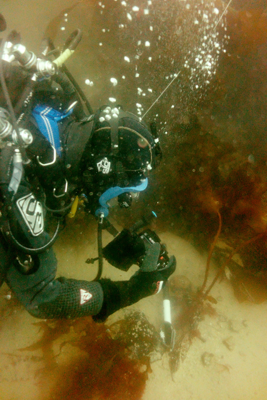
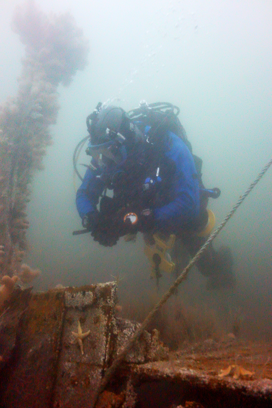
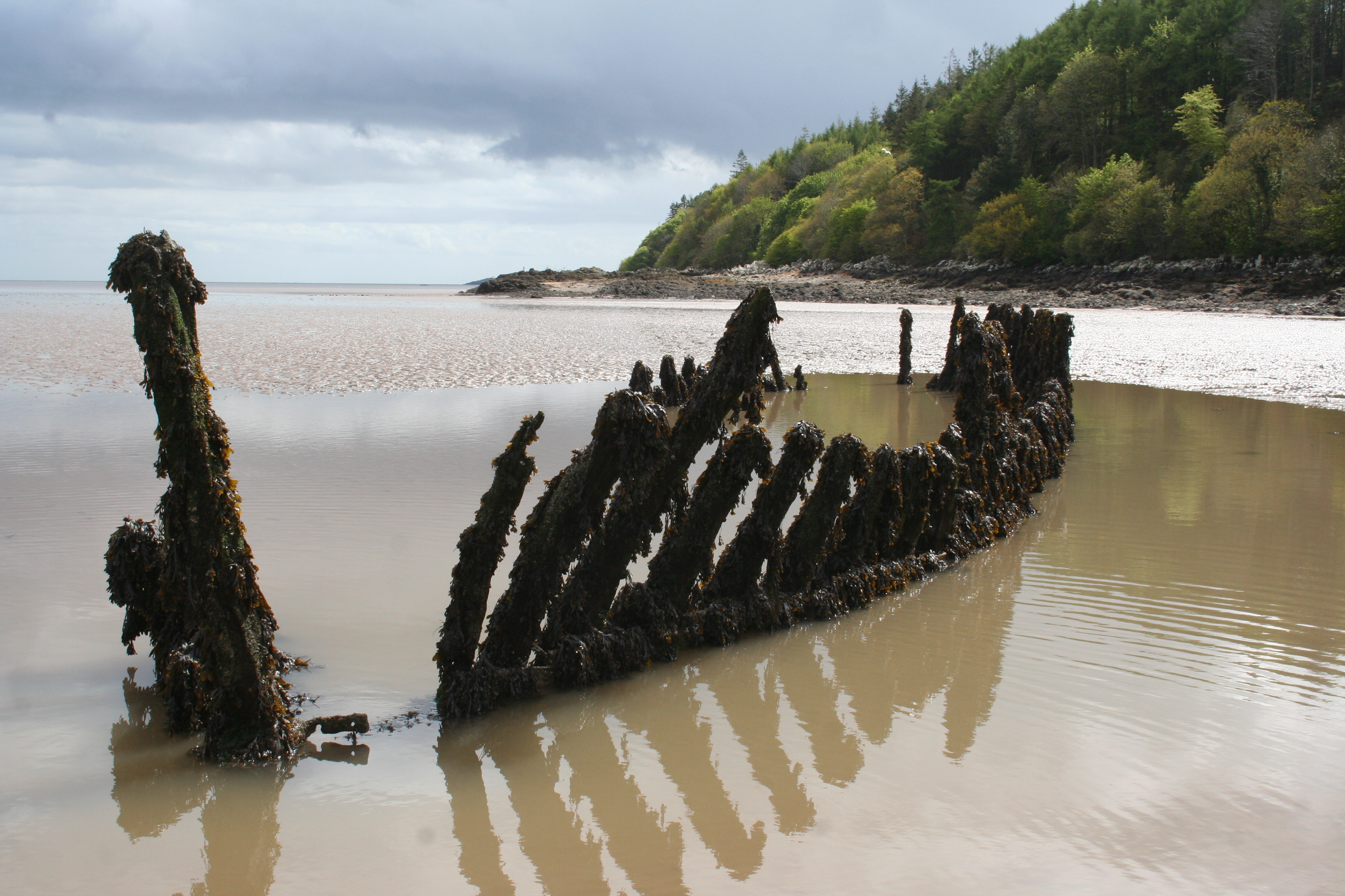
Yesterday’s  first dive for the SAMPHIRE team was on the Short Sunderland in the Firth of Lorn, one of several flying boat wreck sites recorded as part of last year’s SAMPHIRE project with the help of the Scottish Association of Marine Science, the Dalriada Dive Club and RAF Brize Norton. As a military loss this wreck, along with all the other flying boats in the area, is legally protected from disturbance under the Protection of Military Remains Act and any divers considering a visit to this location must make sure to look but not touch. The wreck lies on it’s back and it’s wings are largely intact with more extensive damage to the tail area.

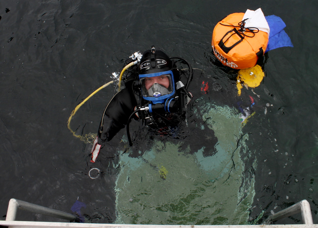
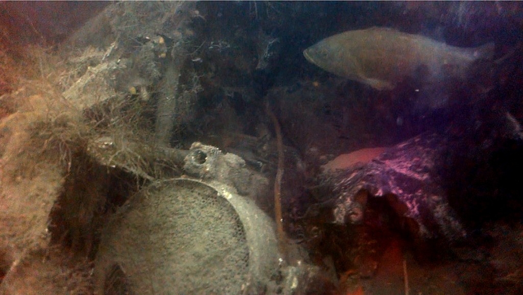
We returned to the site to gather more footage and data which might help us establish whether this is a Mark II or Mark III Sunderland and also to check up on reports of recent dredging damage to the site. We found that there was good visibility on the site and were able to get images and videos across the site. We are also happy to report that the site appears to be in the same configuration as shown on sidescan data from several years ago with no evidence of damage by benthic trawling.
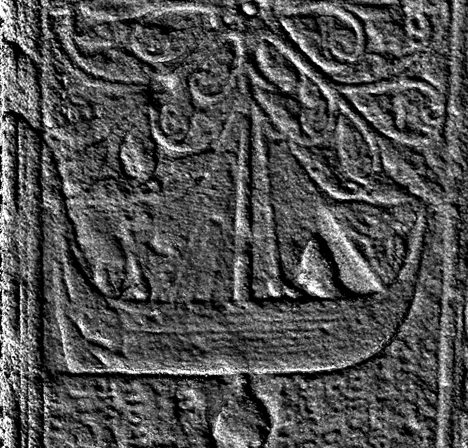
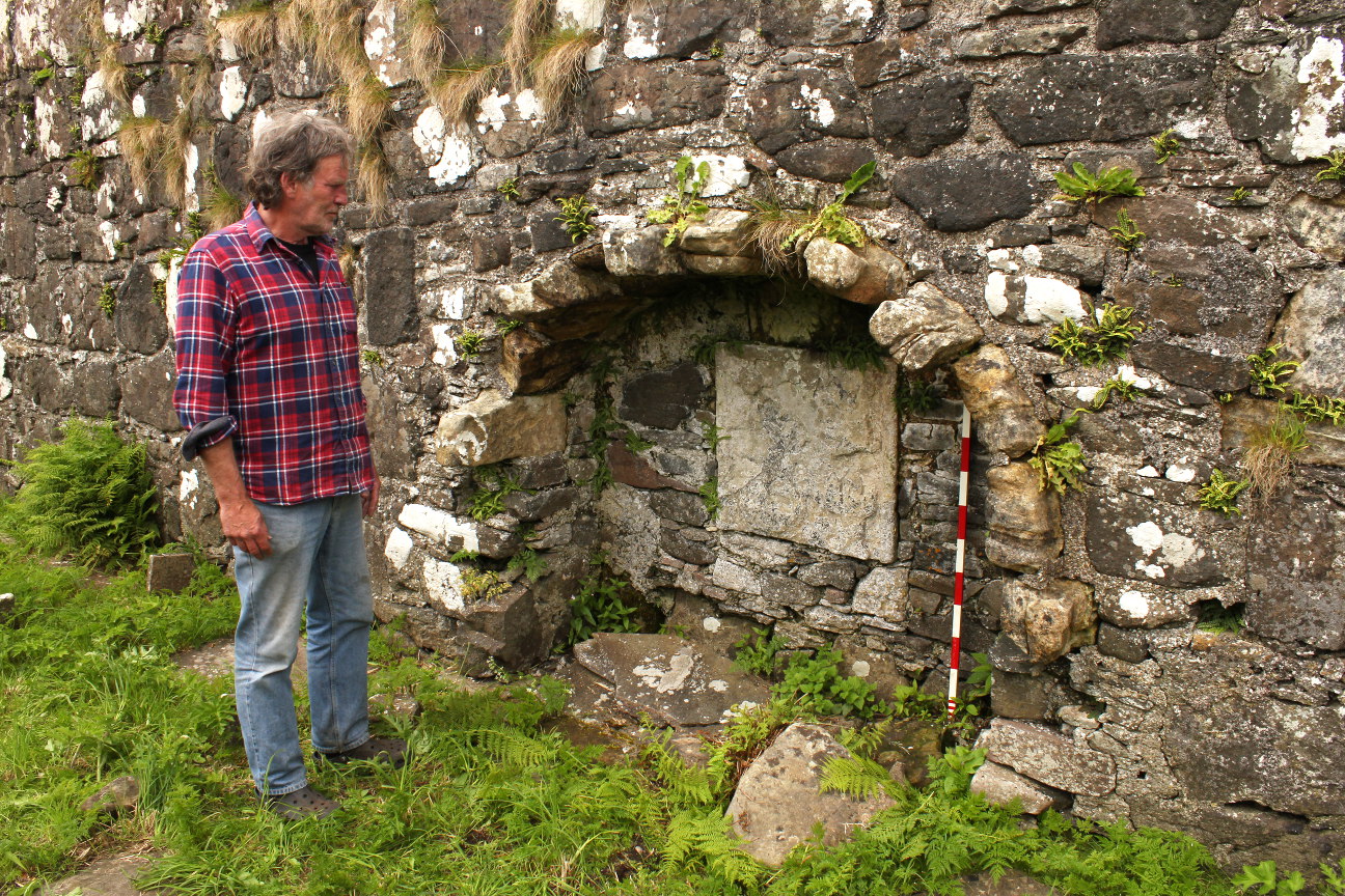
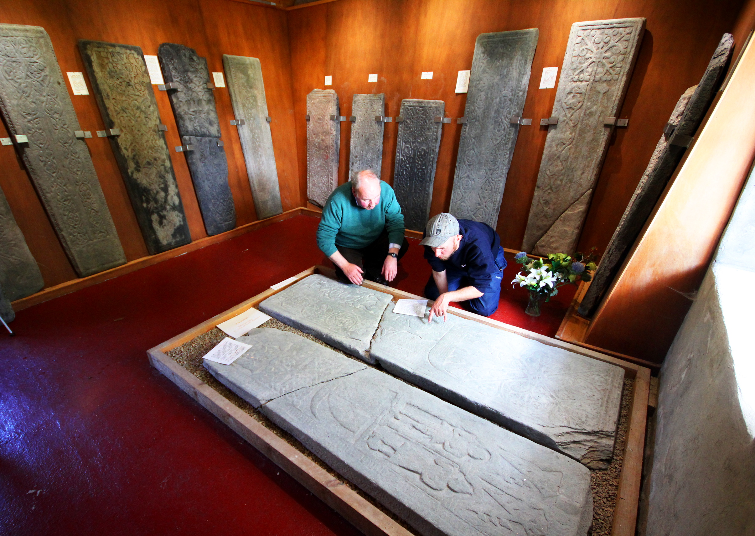
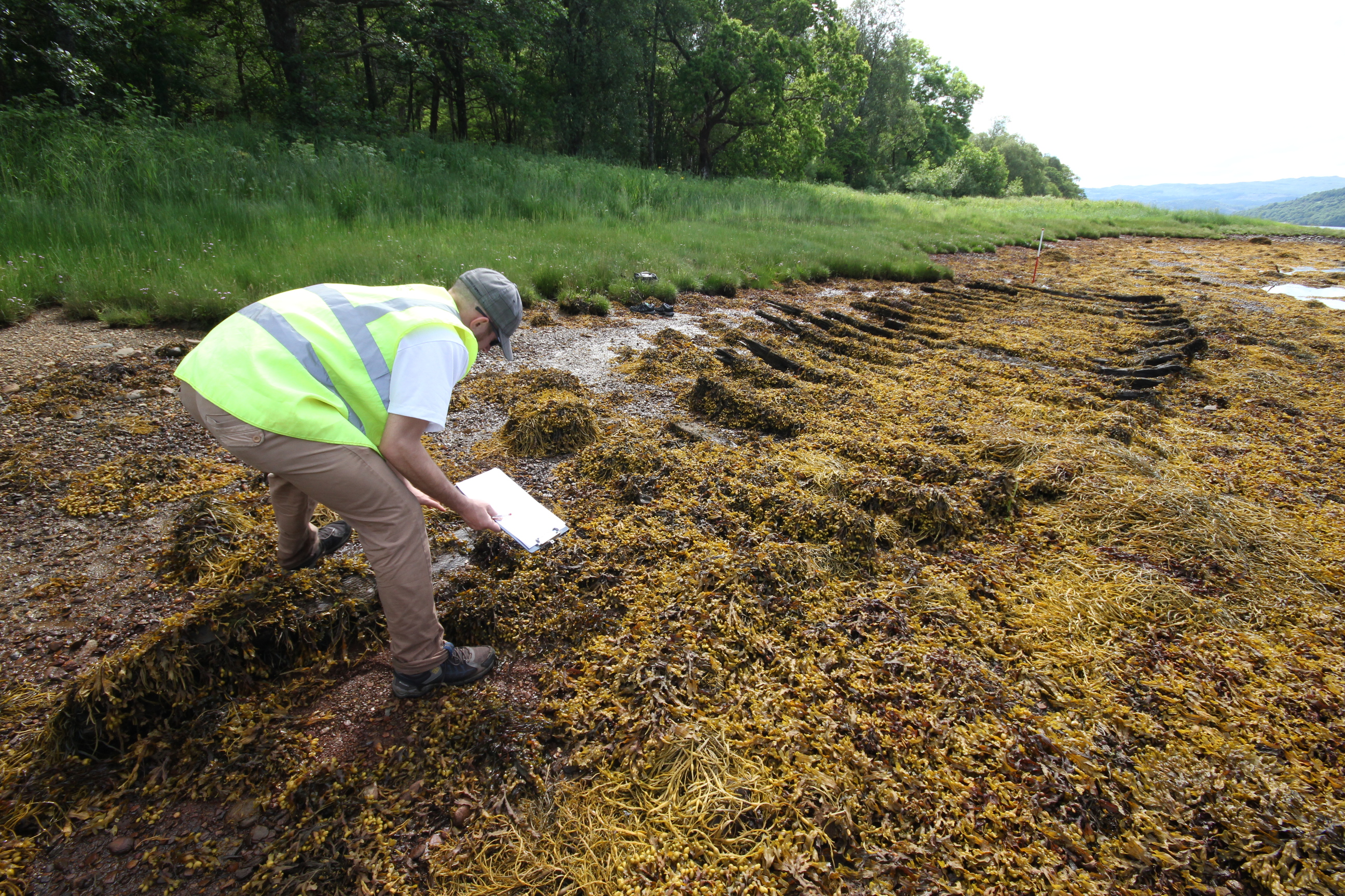
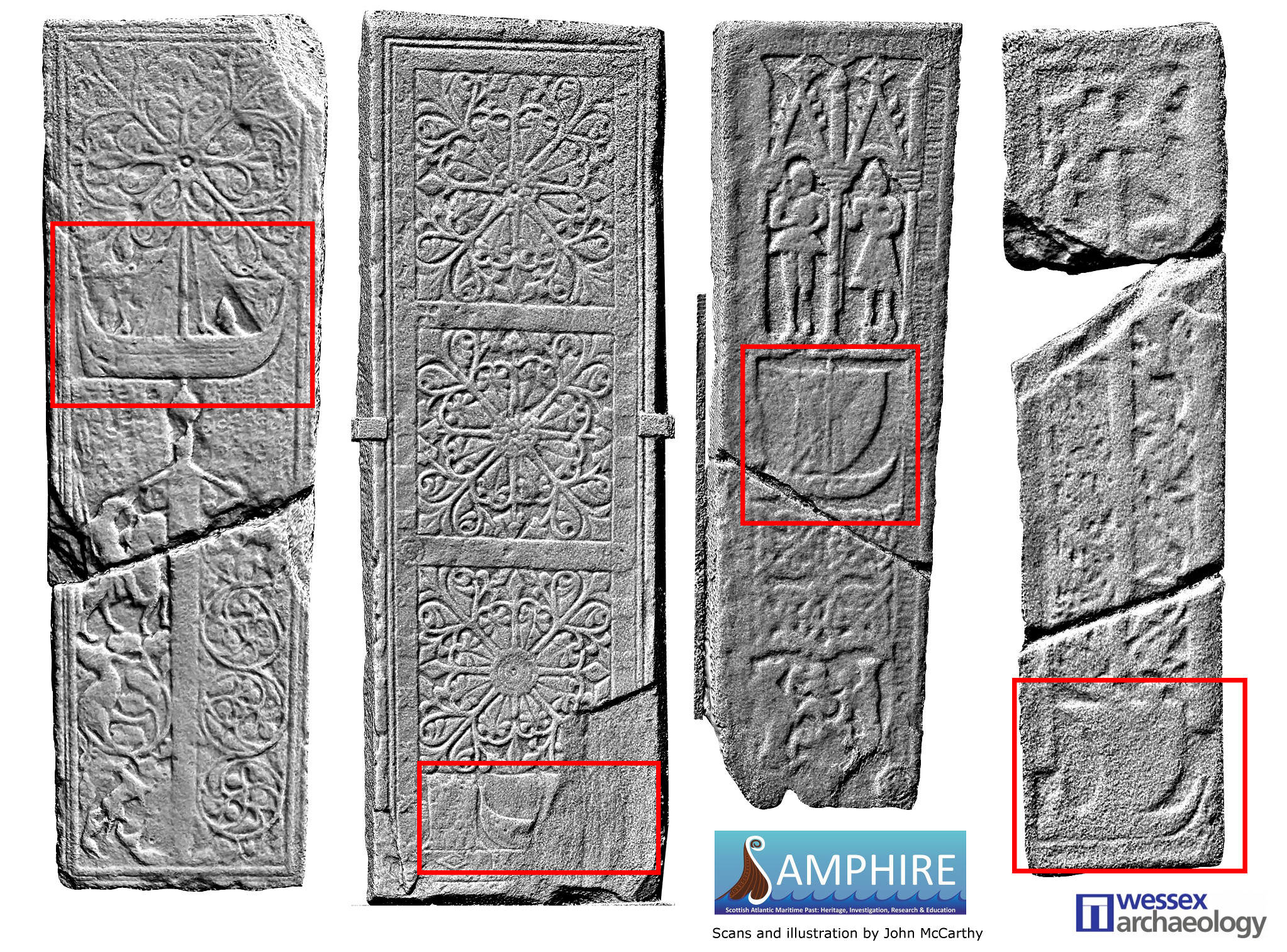
Fyne-al resting place

The SAMPHIRE team stopped near the head of Loch Fyne to check out an intertidal shipwreck reported to us at Ardnoe, first reported to us a few weeks ago by Dr Clare Ellis of Argyll Archaeology. Clare had noticed the site while working on the shoreline nearby and got in touch with us after watching our talk on the SAMPHIRE project at the recent Archaeological Research in Progress (ARP) conference in Edinburgh. After battling our way through marshland we eventually got down to the shoreline and found the wreck. A close inspection showed that it is a large but crudely-built wreck sitting on its keel. It was clearly a large vessel of at least 18m in length with a shallow draught. It is carvel planked with planking held in place with treenails. The gunwales of the ship are now gone but the keel is well-preserved. A fascinating wreck which certainly deserves further investigation and we are going to try to come back to do a more detailed survey at the end of our dive programme this week.

To the border

The final day of the SAMPHIRE community engagement fieldwork on Saturday saw the team covering the last few miles towards the border with England. It seems like a million years ago that we started at Kinlochbervie on the NW tip of Scotland although it’s only been three and we have now travelled the entire west coast of Scotland!

Our stops for the final day included Southerness, where we chased up reported remains of a wooden vessel in the intertidal zone. At the end of the day for the sake of completion we drove the last few miles to the Border. Over the course of our community engagement fieldwork we have covered over a thousand miles and although we didn’t walk it we feel justified in putting a certain Proclaimers song on the stereo! It has been a great trip and we are excited to review all the information we have collected from local maritime communities and start to research and prepare for our diving fieldwork in July!

Kirkcudbright and the Wreck of the Monreith

On Saturday the SAMPHIRE team headed further east to the town of Kirkcudbright. We made our way down to the harbour and quickly found the local harbour master Keith. He was busy with several operations but was happy for us to contact him later. Before we left he also gave us some information about a locally known wreck in the intertidal zone just outside of town.

We followed Keith’s directions and quickly found the site just an hour before low tide. The wreck is visible from the road and has a small plaque dedicated to it just outside of the local carpark. The wreck is the remains of the schooner Monreith from Wigtown, wrecked on the sands here in 1900. We were surprised at how much of the vessel remains despite its significant age and recorded the timbers as best we could with the limited time provided by the tides. There is much more to be learned about this wreck and the others within this area and we look forward to continuing the research!