Pilot Project Completion

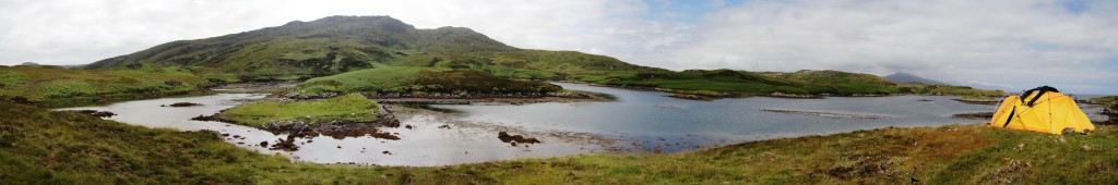
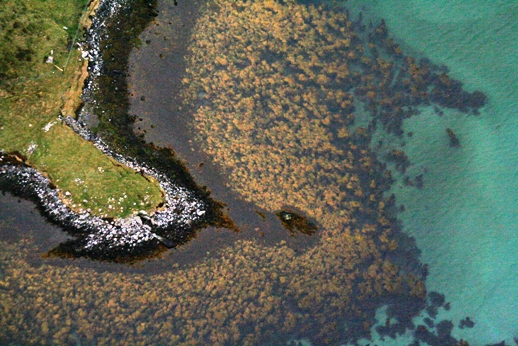
Hartavagh, South Uist: one of our 2012 field locations. Yairs, causeways & a remote historical community (made using AutoStitch: www.autostitch.net).

After two years the pilot project is now complete. We’re putting the finishing touches to the yearly reports which will be online soon on the Downloads page.

I’d like on behalf of the entire project team to thank all those that reported sites, material and helped us in the field. A wide range of archaeological and historical material has been compiled into the reports, so I hope you find something of interest in our project themes:

Marine Resource Exploitation

Hartavagh_diving

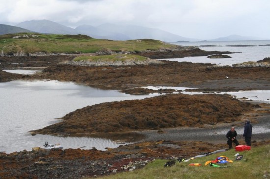
Diving at Hartavagh, South Uist

Maritime History & Transport

Hulk on Grimsay, North Uist foreshore

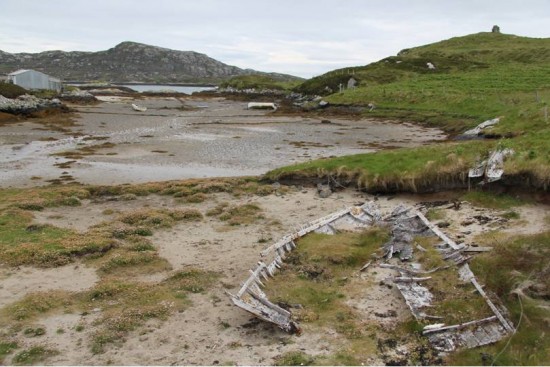
Small wooden vessel on Grimsay, North Uist foreshore

Submerged Prehistory

Geirisclett Neolithic chambered cairn in the intertidal zone, North Uist


OHCCMAPP and the Dynamic Collection

The Dynamic Collection – RCAHMS Annual Review 2011-2012 is out now.

The centre page spread (p14-15) highlights the work undertaken during the OHCCMAPP, jointly between WA Coastal & Marine, RCAHMS and CNE-Siar Archaeology Service, and the importance of working with local people and their detailed knowledge of Scotland’s marine environments. A dynamic and challenging place to work.

The Dynamic Collection - RCAHMS Annual Review 2011-2012

The Dynamic Collection - RCAHMS Annual Review 2011-2012

Aerial survey of the Outer Hebrides: partly submerged prehistory!

Following on from November’s aerial survey we have looked into ways to present some of the archaeology from the air. Several aerial shots of the chambered cairn at Geirisclett, North Uist have been compiled into a 3D photogrammetry model.

The cairn is located at the tip of a small promontory and is now partly inundated at high tide, see the monument here in its current coastal environment.

Fishtraps, fishtraps, everywhere!

During the aerial photography survey of the intertidal zone of the Outer Hebrides several new sites have been discovered. Many of these features are stone-built walls, probably fishtraps  – often called ‘yairs’ in Scotland. They are also likely to be useful causeways too.

We count five intertidal walls from this intertidal inlet at Hartavagh, South Uist – how many can you spot?


Aerial survey of the Outer Hebrides

Earlier this week a small team from WA Coastal & Marine and RCAHMS made a series of flights from Barra to Lewis involving detailed aerial photography of the intertidal zone in the hunt for previously unrecorded sites. BBC Alba reported on the proceedings.

It was a very successful trip identifying several new sites including a spectacular complex of yairs (fish traps). Over the next few weeks the results will be analysed and reported.

More to follow soon!