The COALIE team made a quick trip to Hunterston Sands, North Ayrshire on Wednesday to gauge the impact of the recent storms on the beach and to the archaeology investigated last September. Thankfully the storm surge and terrible weather didn’t appear to have caused any major damage.

COALIE: Investigating historic navigation charts (A. Hale, RCAHMS 2014).
We took the opportunity to investigate some of the coastal structures mapped on early Admiralty Charts of the Clyde surveyed in 1846. Including the site of Hunterston Mill where the course of the Polteath Burn was canalised to run east-west. This left a relict channel running north away from the site through the trees, where it is still preserved, and recorded on recent OS maps. The old meandering course of the burn is clearly shown on the Admiralty Chart.

Polteath Burn looking east; canalised to flow into Fairlie Sands next to the Mill, located on the right bank (A.Bicket, WA C&M 2014).
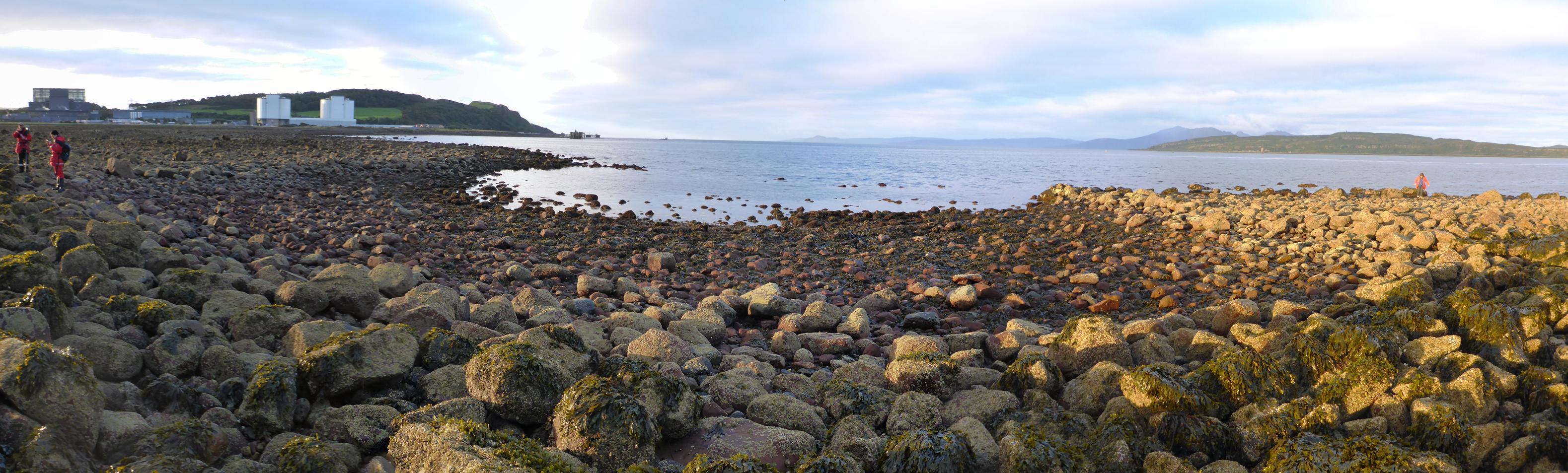
We then visited the large complex of fishtraps on Hunterston Sands as the tide was going out; it’s clear that the structures still work! It was a great opportunity to see how simple lines of boulders carfeully installed along the contours of the coast can be used to pond the water and trap fish. In this case, potentially on quite a large scale.
The fishtraps on Hunterston Sands in action, looking northeast. Ponding the water on the receding tide (A.Bicket, WA C&M 2014).
The fishtraps have some particularly fascinating features, more on those soon…