A call out to local people to report anything unusual they’ve spotted at the shoreline or under the sea to a new archaeological project has already resulted in several promising discoveries.
Tip-offs have led to a possible medieval fishing village and 5,000-year-old pottery submerged in a loch.
The call went out in the summer and autumn to fishermen, beachcombers, divers and residents in the Western Isles.
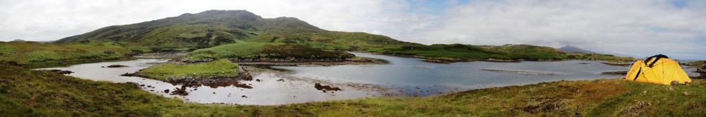
The project is searching for previously unidentified prehistoric and historic remains in the coastal and marine areas of the Isles, from Berneray to the Butt of Lewis and all islands in between.
Many of these places are only accessible for short periods each day due to the tides – or are now fully submerged because of rising sea levels – and have not always been looked at in detail by archaeologists. As a result, it is hoped that this project could lead to a number of significant new discoveries.
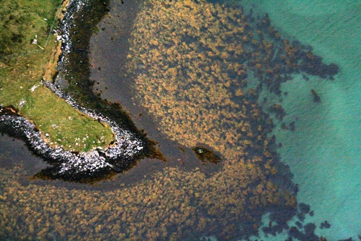
Now members of the project team have had a chance to fly over some of the remote sites they’ve been told about, with an RCAHMS aerial survey team.
Aerial photographs have been taken with the advantage of low winter sunshine, which tends to highlight features in the landscape which can relate to archaeological sites or remains.
Already they’ve identified several sites as warranting further investigation – possibly even full ground and underwater archaeological surveys – in the future.
The discoveries include:
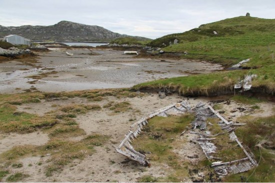
- A local man – JJ McDonald – told the team that he knew of a “medieval fishing station” on South Uist. Photographed from above, the landscape shows high potential for new site discovery of all periods of history. Notably, this area near in Loch Aineort is called ‘Havn’ (the Norse word for harbour) on Ordnance Survey maps.
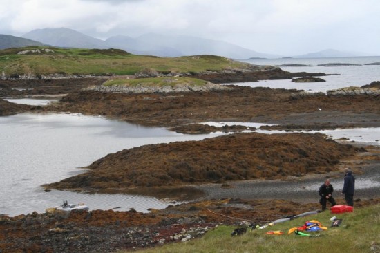
- A previously unknown complex of fish traps and evidence of coastal occupation south of Lochboisdale on South Uist was discovered during the flight surveys.
- At Loch Duna freshwater loch, a local diver has discovered ceramics which date to the early Neolithic period, some 5,000 years ago. He reported this discovery to the local museum just days after attending the first public lecture on underwater archaeology given by the OHCCMAPP team in July.
The project – a partnership between RCAHMS, WA Coastal & Marine, Historic Scotland and Comhairle nan Eilean Siar (CNE-Siar) – aims to get local people involved in sharing their knowledge about features in the landscape, to build up a picture of how people lived and worked on the islands over the last 9,000 years.
Remains found on the coastline, or even now fully underwater, can then be recorded, cared for and preserved. With rising sea-levels and the power of the sea, many of these sites are at risk of being lost.
Speaking on behalf of the project, Dr Jonathan Benjamin of WA Coastal & Marine said:
“As full time archaeologists, we don’t have the benefit of observing the shoreline between the low and high tides, day in and day out, year after year. That’s why we’re relying on the knowledge of people who live and work on or near the sea, and who might have noticed something out of the ordinary, either in a fishing net, or at an especially low tide. Their tip-offs can lead to significant discoveries. We’re also explaining to people the sorts of things that we’re interested in, because they may have seen or noticed things in the past, but disregarded them as not important.
“Until now, there’s been no major study focused on the marine archaeology of the Outer Hebrides, and by beginning with the intertidal and shallow waters, aerial survey and community engagement, we hope to be able to demonstrate that there is a vast amount of knowledge, literally waiting to be discovered by archaeologists working with local residents on land, in the air and underwater.”
Speaking about one of the most promising tip-offs received to date, Dr Alex Hale, archaeological investigator at RCAHMS, said:
“Meeting JJ MacDonald was one of those fortuitous moments that can only happen when you are in the field. We bumped into JJ at his boat shed, by chance, and the amount of knowledge he has of the local environment is incredible. He’s obviously very knowledgeable about the area of South Uist where he lives and was able to help us identify sites that we’ll now be able to investigate further, such as the fishing station.”
For more information about the project or to have a chat about getting involved, people can email visit the project website or email marine@rcahms.gov.uk
For further information or high resolution images, please phone Shaheena Abbas, Pagoda PR on 0131 556 0770 or email shaheena.abbas@pagodapr.com
-ENDS –
Notes for Editors
- The Outer Hebrides Coastal Community Marine Archaeology Pilot Project (OHCCMAPP) is a partnership between WA Coastal & Marine, the Royal Commission on the Ancient and Historical Monuments of Scotland (RCAHMS), Historic Scotland, CNE-Siar and the communities of the Outer Hebrides. https://wessexarch.co.uk/alba
- RCAHMS is the National Collection of materials on Scotland’s built environment that connects people to places across time. It is the first port of call for information about the built environment of Scotland, from prehistory to the present and records the changing landscape of Scotland and collects materials relating to it. www.rcahms.gov.uk
- WA Coastal & Marine is a part of Wessex Archaeology, a non-profit company and a registered charity with offices throughout England and Scotland. In addition to working closely with developers as an archaeological consultancy, as a charity WA is established to promote the education of the public in the subjects of culture, arts, heritage and science through the pursuit of archaeology. www.wessexarch.co.uk
- The role of Western Isles Archaeology Service is to identify and protect the archaeological resource of the Outer Hebrides, promote a greater awareness and understanding of the Islands’ rich archaeological heritage and encourage a sustainable approach to managing change within the Historic Environment. www.cne-siar.gov.uk/archaeology
- Historic Scotland is an executive agency of the Scottish Government charged with safeguarding the nation’s historic environment. The agency is fully accountable to Scottish Ministers and through them to the Scottish Parliament.www.historic-scotland.gov.uk
[AMENDED 18/01/2012]